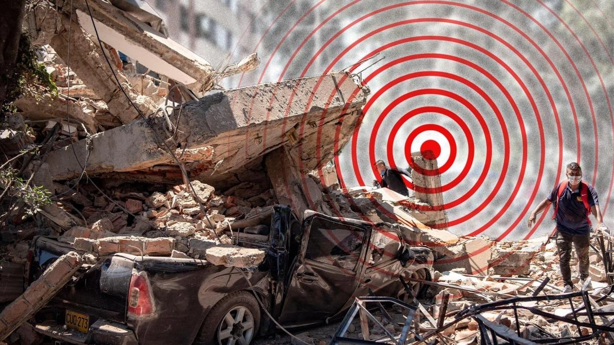

The strong earthquake of magnitude 7.4 that shook western Colombia on Monday morning, local time, caused dozens of deaths and significant material damage.
The epicenter of the earthquake took place at a depth of approximately 107 km, according to the United States Geological Survey (USGS), and was recorded in the municipality of San José del Palmar, in the department of Chocó.
However, the earthquake was felt in much of Colombia, as well as in Panama, Venezuela and several provinces of Ecuador, including Pichincha, whose capital is Quito.
The new Colombian president, Abelardo de la Espriella, who had been sworn in less than 72 hours before the earthquake, declared a state of national emergency and announced that at this moment “the priority is to rescue the people who are under the rubble.”
The earthquake was the “strongest that has been felt in the last decade” in Colombia, stated the general director of the Colombian Geological Service, Julio Fierro Morales.
Due to its location on the interaction zone of the Nazca, Caribbean and South American tectonic plates, Colombia is one of the nations with the highest seismic activity in Latin America and has been the scene of large-magnitude earthquakes.
The rocky shell of the Earth "is broken into pieces like a puzzle and those pieces move. The movement between the pieces is what generates earthquakes," explains Germán Prieto, professor in the Department of Geosciences at the National University of Colombia.
The earthquake recorded this Monday occurred because the Nazca plate, located in the Pacific Ocean, went under the South American plate in an easterly direction, where Colombia is located, Prieto points out.
The subduction of the Nazca Plate advances under the continent at a speed of 55-60 millimeters per year, accumulating pressure and energy that is eventually released in the form of earthquakes.
Colombia is located in the so-called Pacific Ring of Fire, an extensive strip that surrounds the Pacific Ocean and concentrates most of the world's seismic and volcanic activity.
The belt runs from Chile and Peru to Colombia, passing through Central America, then Canada, Alaska, Kamchatka, Japan and the Mariana Islands. He eventually ends up in New Zealand and Tonga.
“All of these regions have active volcanoes and earthquakes,” says Prieto.
In Colombia, on average, close to 2,500 earthquakes are recorded per month (about 80 per day). The majority are of low magnitude, the population does not perceive them and they are only recorded in technical reports, according to the Colombian Geological Service.
Among the largest earthquakes recorded is that of January 31, 1906 with a magnitude of 8.8 and its epicenter off the Colombian and Ecuadorian Pacific coasts. The force released was so great that it generated a tsunami that hit a good part of the Pacific coast.
And the one in 1979 of magnitude 8.1 off the coast of Nariño.
Earthquakes are measured using various scales that evaluate their magnitude and intensity.
The magnitude reflects the energy released at the epicenter, while the intensity describes the effects observed at the Earth's surface.
The moment magnitude scale is logarithmic and non-linear. Each unit jump is equivalent to a release of energy about 33 times greater.
Several governments on the continent, including the United States, Ecuador, Brazil, El Salvador and Venezuela, offered to send teams of rescuers to contribute to the search for survivors and victims.
The hospitals of Cali, capital of the department of Valle del Cauca and one of the cities most affected by the earthquake, declared a hospital red alert as they were at 100% of their capacity.
Cali, Pereira and Manizales decreed a curfew due to the earthquake emergency.
“We have threats of looting, that is why I have ordered the curfew and the militarization of Cali,” said the mayor of Cali, Alejando Eder, who asked citizens to report any attempted looting or insecurity situation.
“These first 48 hours are critical so that we can rescue alive all the people who may be trapped in the collapsed buildings,” he added.
For his part, the mayor of the Colombian city of Pereira, Mauricio Salazar, also declared a curfew to prevent looting after the earthquake that shook much of the country.
A tower of the cathedral in the municipality of Manizales, capital of the department of Caldas, collapsed in the earthquake. The Manizales Cathedral is considered one of the architectural icons of the area and was built between 1928 and 1939.