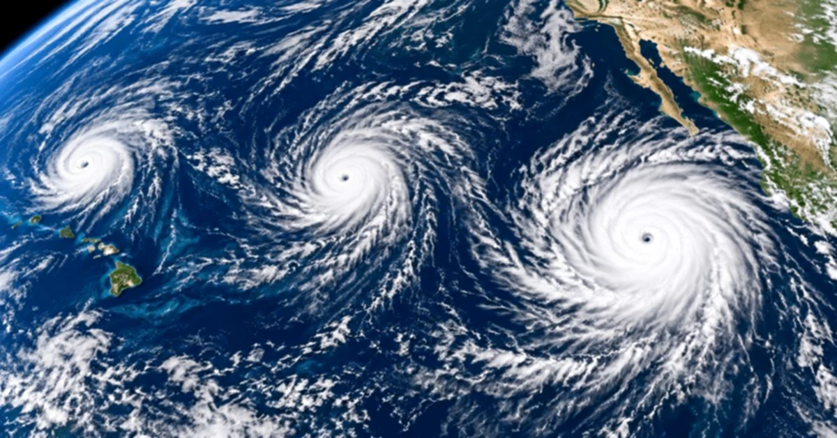

The Pacific Ocean presents an unusual image on Friday: three hurricanes are active simultaneously between the coasts of Mexico and Hawaii.
It is the Polo, Odalys and Nolo, three systems that present different intensities and trajectories but coincide simultaneously over the eastern and central Pacific.
The most powerful is Polo, which on September 25 again reached category 5, the maximum of the Saffir-Simpson scale, with winds sustained of around 180 mph (285 km/h).
Meanwhile, Odalys reached category 4 during the day and Nolo strengthened to become a category 2 hurricane south of Hawaii.
The three cyclones occupy different sectors of an extensive ocean strip.
In the 2:00 PM MST warning on Friday, the National Hurricane Center (NHC) that the cycloneined sustained maximum winds of 180 mph.
Its center was approximately 320 miles southwest of Cabo Corrientes, Mexico, and 395 miles south of Cabo San Lucas.
Polo moved west at about 10 mph. There were no coastal warnings in force at the time, but the NHC asked those in Lower South California to closely follow the evolution of the system, as warnings could be needed for parts of the peninsula.
Polo had already brought heavy rains and dangerous waves to sectors of the Mexican coast in recent days.
Much further west is Odalys.The system experienced a rapid intensification during Friday and reached category 4, with winds close to 130 mph during the morning.
Unlike Polo and Nolo, Odalys is very far from land.
The NHC it was approximately 955 miles west-southeast of the southern extreme of Lower California during the morning and that there were no coastal warnings or warnings due to the cyclone.
During the afternoon it began to show signs of weakening, although it was still a larger hurricane.
The third hurricane is Nolo, located south of the Hawaiian Islands.
The system strengthened during Friday morning and reached category 2, with sustained winds of approximately 105 mph (165 km/h).
Its center was about 185 miles south of South Point, on the Great Island of Hawaii, and about 380 miles south-southeast of Honolulu.
But in this case, the biggest concern is not only the wind.
The Central Pacific Hurricane Center has warned that Nolo could generate sudden catastrophic and potentially deadly floods on the Grand Island over the weekend.
The Grand Island was under tropical storm warning and hurricane surveillance, while other areas of Maui County remained under tropical storm surveillance.
This is not an ordinary situation.
The San Francisco Chronicle that this is the second time in just three weeks that three hurricanes spin simultaneously in the Pacific between Mexico and Hawaii during this season. Before September 2026, a comparable configuration had occurred only once in the modern record cited by the medium.
One of the most extraordinary precedents occurred in August 2015.
At that time, Hurricanes Kilo, Ignacio and Jimena coexisted as three category 4 hurricanes simultaneously in the central and eastern Pacific.
NOAA then noted that it was the first time recorded that three major hurricanes were active simultaneously in that region.
The current situation is not exactly the same: Nolo is category 2, so the three current systems are not major hurricanes at the same time.
Activity in 2026 is well above what is normally seen in the Pacific.
The National Hurricane Center recorded up to September 25 16 named storms and six hurricanes in the eastern Pacific, with accumulated cyclone energy approximately 54% higher than the average for 1991-2020.
NASA also noted that, on September 24, the accumulated cyclone activity in that region was close to twice the normal and related the active season to the general conditions associated with El Niño, although it clarified that the rapid intensification of an individual hurricane cannot be directly attributed only to that phenomenon.
The case of Polo is striking.
NASA described its intensification as extraordinary rapid after the system moved from a tropical storm to a powerful hurricane over exceptionally warm waters in front of Mexico.
The cyclone found almost ideal conditions for strengthening: low winds, abundant humidity, warm waters and high atmospheric instability.
During Friday, NOAA Hurricane Jets again measured Category 5 winds inside Polo.
Although the three hurricanes are active simultaneously, they do not represent the same level of threat to land.
At this moment:
Cyclone trajectories and intensities can change rapidly, so both the NHC and the Central Pacific Hurricane Center continue to update their forecasts.