
Although on the surface it may seem that things are going on normally, deep inside the Earth there is a constant movement of the tectonic plates.
A movement that, without prior warning, can shake entire cities, as happened this Monday with the powerful earthquake that shook western Colombia and had its epicenter in the municipality of San José del Palmar, in the department of Chocó.
The 7.4 magnitude earthquake, according to the United States Geological Survey (USGS), had a depth of 107 km, and occurred at 7:34 am local time, being felt in much of the country.
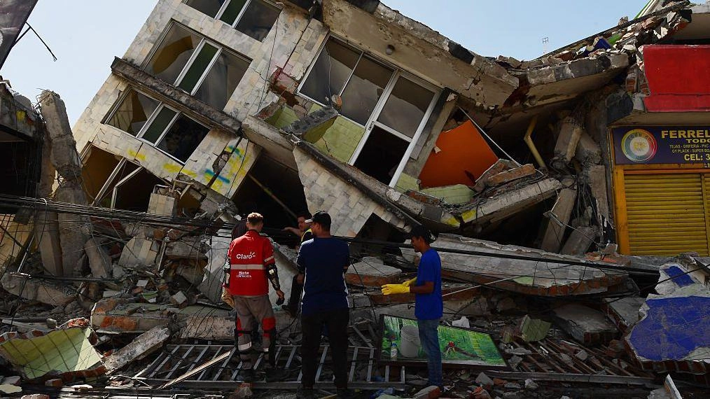
Authorities reported that the earthquake caused dozens of fatalities and material damage in cities such as Pereira, Manizales and Cali.
It is the “strongest earthquake that has been felt in the last decade in the country,” said Julio Fierro Morales, general director of the Colombian Geological Service.
According to the organization, the seismic activity recorded in this area responds to the natural tectonic dynamics of western Colombia and is associated, among other processes, with the movement of the Nazca plate.
The country's geological characteristics help explain why other earthquakes of considerable magnitude have been recorded in the past.
Germán Prieto, professor at the Department of Geosciences at the National University of Colombia, explains that the country is located on the boundary between tectonic plates.
For that reason Colombia is a seismically active country. Rigid and cold, tectonic plates are the most superficial layer of the Earth, while the interior is hot.
“You can think of an egg, with a soft interior and a hard shell,” Prieto explains to BBC Mundo.
That rocky shell of the Earth "is broken into pieces like a puzzle and those pieces move. The movement between the pieces is what generates earthquakes," says the expert.
Following that analogy, the pieces that move are the tectonic plates, whose movement and friction generates earthquakes.
The earthquake recorded this Monday occurred because the Nazca plate, located in the Pacific Ocean, goes under the South American plate.
That is what is known as subduction: a phenomenon that occurs when one plate sinks and slides under the other.
The Nazca plate slides under the South American plate to the east, where Colombia is located, says the academic.
When the plates are in motion, they accumulate elastic energy, until the friction no longer resists and that energy is released in the form of an earthquake.
The importance of depth
The earthquake recorded this Monday in Colombia was of great magnitude; it does not mean, according to the information available to date, that it is the most destructive.
In fact, the magnitude of an earthquake is only one of the factors that influence its destructive power.
Another decisive factor is depth. “It was a fairly deep earthquake, which means that the waves reach the surface attenuated,” explains Sergio Barrientos, director of the National Seismological Center of the University of Chile.
In this case, a subduction occurred because the Nazca Plate fractures internally and penetrates under the South American Plate.
“It is not a contact earthquake between plates,” adds the seismologist, as occurs in Venezuela, Peru, Ecuador or Chile. Contact tremors are usually more superficial.
Depth is precisely one of the causes that explains why the earthquake in the Colombian coffee region of 1999 had great destructive power.
On that occasion, the earthquake had a magnitude of 6.2, but - unlike the current one - it was much more superficial and left nearly 1,200 dead, according to official figures.
Seismicity in western Colombia responds to the natural dynamics of subduction of the Nazca Plate, which advances under the continent at a speed of 55-60 millimeters per year, accumulating pressure and energy that is eventually released in the form of earthquakes.
The subduction movement is related to the boundaries of the tectonic plates, says Colombian expert Germán Prieto. The limit can be divergent, convergent and transformation.
In the earthquake that occurred in the west of the country, the boundary between the plates is convergent, that is, they move in opposite directions and one of them, generally the oceanic one, slides underneath.
This type of phenomenon is common in various parts of the world, explains the expert. “The Pacific Ring of Fire is an expression of several convergent boundaries and subduction, which have associated earthquakes and chains of volcanoes.”
It goes from Chile and Peru to Colombia, passing through Central America, then through Canada, through Alaska, Kamchatka, Japan and the Mariana Islands. He eventually ends up in New Zealand and Tonga.
“All of these regions have active volcanoes and earthquakes,” he points out.
Is it connected to the Venezuela earthquake?
The president of the Venezuelan Society of Geologists, Feliciano de Santis, tells BBC Mundo that the earthquake in Colombia and the one that recently occurred in Venezuela are not directly connected.
“In Venezuela and Colombia we share the South American Plate and the Caribbean Plate, but the connection between the earthquakes is very indirect,” he explains.
“One cannot say that every time it shakes in Venezuela it will shake there later,” although the two countries are part of an entire system of interconnected plates. “It's like the peel of a tangerine that is broken in several places and they all interconnect.”
In Venezuela, the expert adds, there is a different fault system. “Their system is deeper.” And it is precisely that depth that helps mitigate damage.
“In Venezuela the systems are more superficial because our plates rub laterally and they have a compression system in which one plate goes under the other,” explains de Santis.
It is, basically, a different tectonic model.
Colombia, a seismic country
As Colombia is one of the nations with the highest seismic activity in Latin America - due to its location above the interaction zone of the Nazca, Caribbean and South American tectonic plates - it has been the scene of large-magnitude earthquakes.
Among the largest is that of January 31, 1906 with a magnitude of 8.8 and its epicenter off the Colombian and Ecuadorian Pacific coasts. The force released was so great that it generated a tsunami that hit a good part of the Pacific coast.
And the one in 1979 of magnitude 8.1 off the coast of Nariño.
In the recent history of the country, some earthquakes have seriously impacted the country, such as the one in 2004 whose magnitude was 7.2, or the La Vega earthquake in 2012 with magnitude 7.1.
But since the magnitude does not necessarily determine the impact, other less powerful earthquakes have caused havoc in the country due to their proximity to populated areas or the vulnerability of buildings.
An example is that of Armenia in 1999, which left 1,185 fatalities or that of Páez in 1994, which also caused more than 1,000 deaths.