

7.4 earthquake shakes Colombia: shocking images of the destruction
Today's 7.4 magnitude earthquake in Colombia left dozens of buildings collapsed, so far there are 111 dead, and almost 90 injured
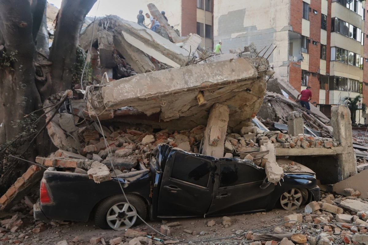

Colombia woke up this Monday with one of the strongest shocks in recent decades. During the morning of this Monday, a 7.4 magnitude earthquake shook the west of the country and left in its wake collapsed buildings, destroyed homes, affected streets and emergency scenes that were quickly recorded on videos.
The epicenter was located in the municipality of San José del Palmar, in the department of Chocó, at a depth of 82 kilometers, according to the Colombian Geological Service (SGC). The United States Geological Survey (USGS) calculated a magnitude of 7.4 and a depth of close to 107 kilometers.
The images show the dimension of the emergency: structures that collapsed, damaged facades, vehicles displaced by the movement and people who abandoned the buildings amid fear of new aftershocks. In some areas, rescue teams began working through the rubble in search of trapped people.
The director of the Colombian Geological Survey, Julio Fierro Morales, described the movement as the “strongest earthquake that has been felt in the last decade in the country.”
The extent of the damage became clear hours later. President Abelardo de la Espriella, who took office only last Friday, reported a preliminary toll of 111 people dead and 87 injured. In addition, it reported 1,575 damaged homes, 37 completely destroyed and 61 collapsed buildings.
"The first thing is the rescue of the people who are under the rubble. That is the priority," said the president when announcing the declaration of a national disaster.
The emergency hit Chocó, Valle del Cauca, Risaralda, Caldas and Quindío with special force. Pereira, Cali, Manizales, Armenia and Quibdó reported significant damage, while authorities evaluated the situation in other municipalities.
The earthquake also affected essential infrastructure. According to the balance presented by De la Espriella, 18 health centers and 52 educational centers suffered damage. 18 roads and seven airports were also affected: Pereira, Manizales, Quibdó, Armenia, Cartago, Cali and Buenaventura.
In Pereira, one of the hardest hit cities, images captured damaged buildings and rescue operations. In Manizales, damage to emblematic buildings was also reported, while in Cali several structures were seriously damaged.
The tragedy also brought back to the memory of Colombians the earthquake that devastated the Coffee Region in 1999, when a 6.2 magnitude earthquake mainly hit Armenia and left around 1,900 dead.
This time, the depth of the movement did not prevent damage. The earthquake occurred in a region with high seismic activity and its impact reached much of the west and center of the country.
While rescue efforts and the evaluation of structures continue, images of buildings reduced to rubble, streets covered in materials and families gathered in open spaces show the true scope of a tragedy that is just beginning to take shape.
The authorities maintain search and rescue operations due to the possibility of finding more people in the rubble, so the number of victims could increase.
This news has been tken from authentic news syndicates and agencies and only the wordings has been changed keeping the menaing intact. We have not done personal research yet and do not guarantee the complete genuinity and request you to verify from other sources too.