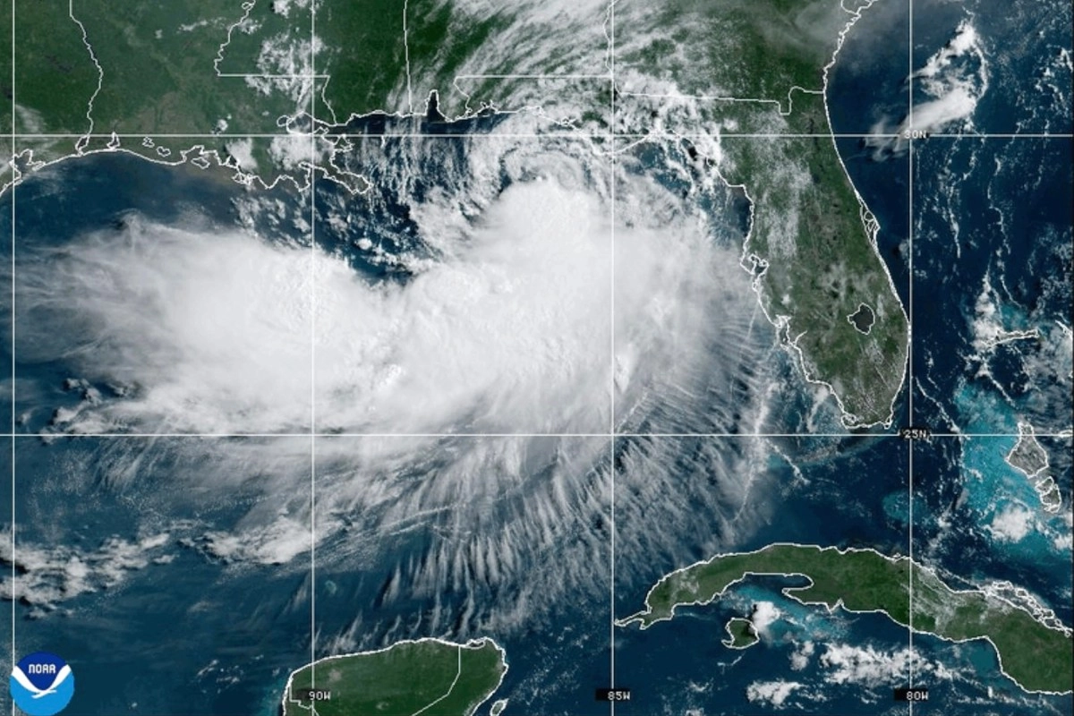

Tropical Storm Bertha continues to move slowly through the Gulf of Mexico while keeping several states on the southern coast of the United States on alert for the risk of heavy rains, strong winds, storm surges and dangerous rip currents.
According to the National Hurricane Center (NHC), this Tuesday morning the system was located approximately 110 miles south-southwest of Panama City, Florida, with a movement towards the northwest of around 5 mph and maximum sustained winds of 50 mph.
Authorities issued tropical storm warnings and watches for sectors of northwest Florida, Alabama, Mississippi and southeastern Louisiana, including the cities of Panama City, Pensacola, Mobile, Gulfport and New Orleans, the latter under watch.
Bertha will move towards Louisiana before weakening
The system originated as a tropical depression over the weekend and strengthened Monday night into a tropical storm.
According to the NHC forecast, Bertha will continue to move slowly along the Gulf Coast through Tuesday and approach southern Louisiana on Wednesday, although it is expected to remain a relatively weak tropical storm.
Subsequently, the cyclone will move westward towards Texas while losing intensity. Forecasters expect it to downgrade back to a tropical depression between Thursday and Friday before dissipating or becoming a post-tropical system.
Rain, storm surge and dangerous currents
Although no major impact from widespread flooding is expected, Bertha will leave adverse weather conditions in several Gulf states.
The forecast calls for scattered showers and thunderstorms throughout Tuesday along the Gulf Coast and northwest Florida. Between Tuesday and Wednesday, precipitation will spread into southern Alabama and Mississippi.
Rainfall accumulations could range between 2 and 4 inches, with isolated amounts of up to 8 inches in some coastal areas through Friday.
Additionally, authorities warned of a storm surge of between 1 and 4 feet, as well as the possibility of life-threatening rip currents on beaches in the Gulf of Mexico.
New Orleans could see tropical storm winds
Rain and gusty winds are expected in New Orleans from Tuesday night into Thursday. Some gusts could reach tropical storm intensity, although meteorologists believe that the most significant impacts will remain over the waters of the Gulf.
The National Hurricane Center also indicated that Bertha will maintain an asymmetric structure, so most of the rain and the most intense winds will remain south of the center of circulation, mainly over the sea.
Authorities recommend residents in areas under surveillance remain attentive to forecast updates and follow the instructions of local emergency services during the passage of the system.